Coordinates
12.9714°S · 38.5014°W
Salvador, Bahia
Open to international remote · UTC−3
Software developer · Full-stack · Brasil
Software Developer at SIHS (Government of Bahia). I ship production products end to end — React/TypeScript UIs, Node APIs, databases, and geospatial tools when the domain needs maps.
 React
React  TypeScript
  Node.js
  ArcGIS
  PostGIS
  MapLibre
  QGIS
QGIS 
toolchain










stack.manifest
Full stack in production — UI, APIs, data, GIS, and delivery.
# inspect --module APP-01
$ status
  name      Application layer
  runtime   React · TypeScript · Vite · Tailwind
  flag      PRIMARY

$ capabilities --verbose
  ▸  React + TypeScript for government and enterprise surfaces
  ▸  Portals, dashboards, ops tools — usable by non-technical staff
  ▸  REST clients, auth flows, and third-party integrations
█Coordinates
12.9714°S · 38.5014°W
Salvador, Bahia
Theatre
Brasil · South America
Atlantic seaboard
Domain
Software products
Web · APIs · GIS
Sector
Public infrastructure
SIHS · Government of Bahia
Local time
UTC−3
America/Bahia · open to worldwide remote
01 Profile
I build and ship software end to end — interfaces, APIs, and data. GIS is one of my strongest stacks, not the only thing I do.
02 Selected work
Government platforms, ops tools, and web products — including GIS when the problem needs a map.
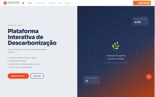 Live demo Deployed
 Maps, dashboards & energy transition
Web GIS for Brazil’s energy transition: MapLibre maps, spatial dashboards, and AI-assisted insights for decarbonization scenarios.
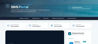 Live demo Deployed
 Government systems intranet
Unified entry point to SIHS digital services for water and sanitation teams — navigation, responsive UI, and TypeScript throughout.
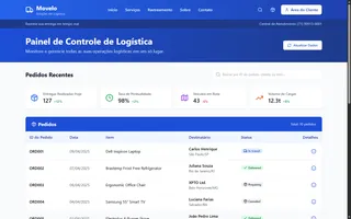 Enterprise
 Fleet tracking & logistics
Internal operations platform with role-based access, location-aware tracking, and dashboards for fleet and logistics teams.
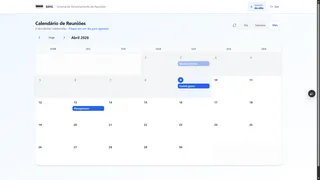 SIHS · Gov In production
 Room booking for government
Room booking with LDAP authentication, admin workflows, and integration with government infrastructure.
03 Experience
SIHS software & GIS, infrastructure support at Paraguaçu, and independent web products.

Secretariat of Water Infrastructure and Sanitation · Government of Bahia
ArcGIS Enterprise for hydraulic planning and water/sanitation networks.
Publish and maintain the GIS stack water teams use in the browser, plus the surrounding software — REST APIs, auth, and internal tools that sit on the same government infrastructure.

Paraguaçu Engenharia
Corporate infrastructure: keep servers, networks, and people unblocked so engineering work can ship.
Independent projects
End-to-end web products for clients — prototype to production, with the same delivery bar as the GIS work: ship it, don’t just demo it.
04 Contact
Open to remote software roles worldwide. Email or LinkedIn — I reply within a day.